Geographic information systems/Mapping
Thematic mapping
Thematic mapping is a type of mapping by which data are grouped and displayed via geographically homogenous units. Data are typically classed into 3 to 7 categories depending upon the number of geographic units being represented.
This particular type of map uses color to represent areas of increasing/decreasing data intensity.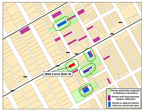
Spatial data manipulation/analysis
Spatial analysis is the process where different geographic layers are used with the intent to create or extract new data based on a specific condition(s). Some processes covered under spatial analysis are geographic aggregation, buffer generation and spatial statistics.
Geocoding
The process of assigning latitude and longitude coordinates to a specific street address for the purposes of mapping and GIS analysis.
Mobile (GIS) data collection
Use of hand held computers to collect "real time" data for the purposes of mapping such things as neighborhood nuisances, public improvements, and housing conditions.